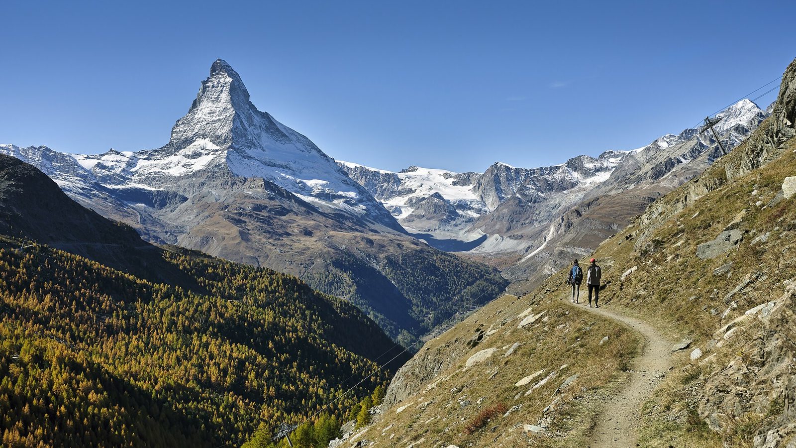
Switzerland’s most famous mountain has a secret that sounds like a pub quiz trick. Climb the Matterhorn, and for the last thousand metres or so, you aren’t standing on Swiss rock at all. You’re standing on African rock.
It’s not a metaphor. The rock of the upper Matterhorn formed on the far side of an ancient ocean, on a block of crust tied to the African continent. Tens of millions of years ago, that block crashed into Europe and rode up over it. Ice then carved it into the most photographed pyramid on earth.
So is the Matterhorn African? Geologists will tell you the answer is “yes, with an asterisk”, and the asterisk is the best part of the story. It explains how two continents built the Alps, why the oldest rock sits on top of the mountain, and why the Matterhorn is still moving today.
Sources: Wikipedia (Matterhorn), Earth Magazine, WSL Institute for Snow and Avalanche Research SLF.
Is the Matterhorn African? The short answer
The short answer is yes. The upper Matterhorn consists of gneiss from the Dent Blanche nappe, a huge sheet of rock that once formed part of Adria. Adria (geologists also call it Apulia) was a block of continental crust attached to the African plate when the Alps began to form. In that sense, the Matterhorn's summit is African.
Now for the asterisk. Geologists still debate when Adria began moving independently of Africa, and today it's usually treated as a microplate in its own right. Its rocks, however, came from the African side of the ancient ocean. So when popular science says the Matterhorn is African, it's a fair shorthand for a slightly messier truth.
The rest of the mountain isn't African at all. Its base consists of old ocean floor, the remains of a sea that once separated Europe from Africa. And far beneath both lies the European plate. The Matterhorn is a three-layer sandwich, and every layer tells a different chapter of the Alps' story.
Inside the Matterhorn: a three-layer sandwich
Picture the Matterhorn, or Cervin in French and Cervino in Italian, as our guide to the Swiss languages explains, cut open like a cake. Up to about 3,400 metres, its rock comes from the ocean floor. Above that, all the way to the 4,478-metre summit, it's African gneiss.
Here's the twist that confuses even geology students: the ages run backwards. The ocean-floor rocks at the base date from the Jurassic and Cretaceous periods. The gneiss above them is far older, and the darkest rock at the summit is the oldest of all. In a normal pile of rock, the oldest layers sit at the bottom. On the Matterhorn, the collision shoved the old African rock over the younger ocean floor.
Tap through the layers below. The Hörnli hut sits on ocean floor, while the tiny Solvay shelter, at 4,003 metres, clings to African rock.
Inside the Matterhorn: three layers, two worlds
Tap a layer, or use the buttons, to see what each part of the mountain is made of.
Simplified. Altitudes of the boundaries are approximate, and the deeper European rocks lie far below the base of the mountain.
There's a lovely irony here. When climbers set off from the Hörnli hut before dawn, they start on the floor of a vanished sea and finish on a fragment of another continent.
How were the Alps formed? A 165-million-year story
To understand how a piece of Africa ended up above Zermatt, you have to rewind a very long way. The slider below runs from the opening of an ancient ocean to today. Drag it slowly and watch the continents move.
Time machine: 165 million years in one slider
Drag from the opening of an ancient ocean to today. Simplified cross-section through the western Alps, not to scale.
An ocean between Europe and Africa
About 165 million years ago, the supercontinent Pangaea was breaking apart. Africa pulled away from Europe, and a narrow ocean opened between them. Geologists call it the Piemont-Liguria Ocean, part of the larger Tethys. On its northern shore lay Europe. To the south lay Adria, the block of crust that would one day become the top of the Matterhorn.
The great reversal
Then, around 100 million years ago, everything changed direction. As the Atlantic Ocean widened, Africa began moving north again, towards Europe. The young ocean between them started to close. Its floor sank beneath Adria in a process called subduction, sliding down into the Earth's mantle.
The collision
Between about 50 and 40 million years ago, the last of the ocean was swallowed, and the European margin itself slid under Adria. The collision scraped slices of ocean floor off and trapped them between the two landmasses, like crumbs caught between two plates.
Some of that ocean floor went astonishingly deep. At Lago di Cignana, on the Italian side of the Matterhorn, geologists have found tiny diamonds in ocean-floor rocks. Around 45 million years ago, those rocks reached pressures found about 100 kilometres underground, and then somehow made it back to the surface.
The deeply buried European rock was lighter than the mantle around it, so it began to rise again. Writing in Earth Magazine, the geologists Terri Cook and Lon Abbott compared it to "a bubble in the bottom of a lava lamp". As it bobbed up, it lifted the ocean-floor rocks and the African crust stacked above it. That's how the Alps rose.
Ice sculpts a horn
For millions of years, erosion attacked the new mountains. It stripped away most of the African lid, leaving only isolated remnants, which geologists call klippen. The Matterhorn is one of them.
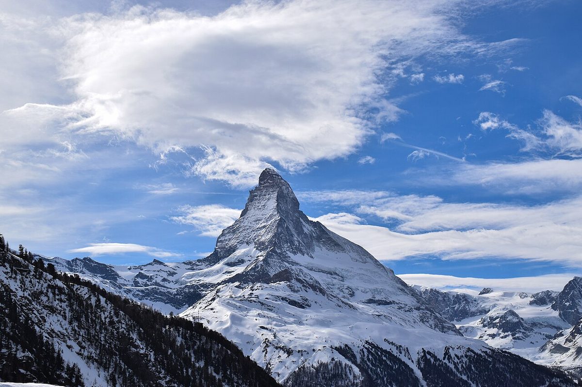
The final touch came from ice. During the ice ages of the last two and a half million years, glaciers ate into the mountain from four sides. Each one carved a steep bowl, and the sharp ridges between them became the Matterhorn's famous edges. Geologists call this shape a glacial horn, and the Matterhorn is the textbook example.
Africa or Europe? Test the famous peaks
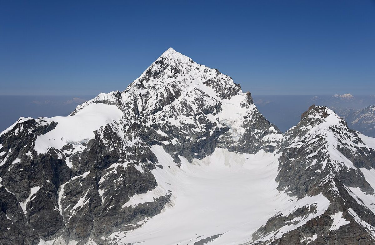
Once you know the story, you'll start reading the Alps differently. The Matterhorn isn't the only African summit in Switzerland. Its neighbours the Dent Blanche, the Weisshorn, the Ober Gabelhorn and the Dent d'Hérens all share the same Dent Blanche rock.
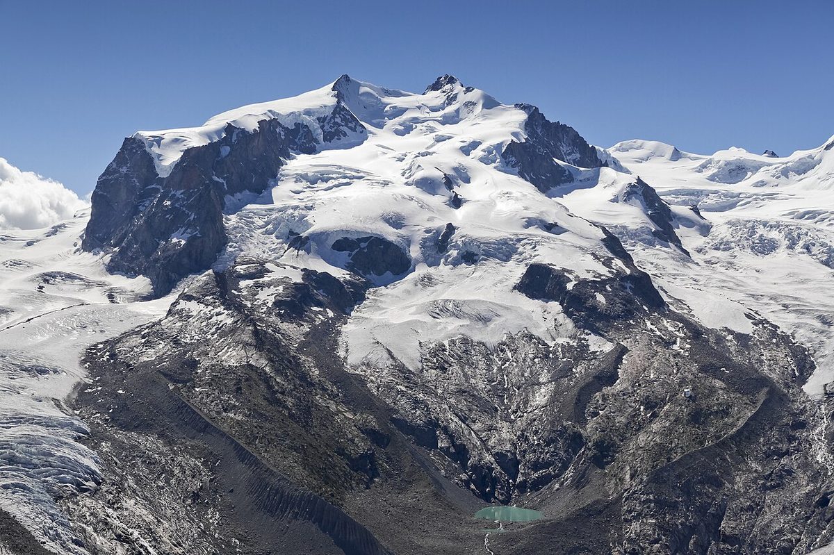
Other giants come from the opposite shore. The Dufourspitze on Monte Rosa, Switzerland's highest summit at 4,634 metres, rose from the European side. So did Mont Blanc. In other words, Switzerland's highest peak is European, while its most famous one is African.
Africa or Europe? Test the famous peaks
Tap a mountain to see where its rock was born.
- Made of
- Where the rock formed
- Verdict
Most of the Bernese Oberland is European too. Both the Jungfrau and the rock beneath the Aletsch Glacier belong to the Aar massif, a piece of old European crust. The same European basement surrounds the Gotthard Base Tunnel, where engineers bored through kilometres of granite and gneiss.
Crossing from Europe to Africa without leaving Switzerland
You don't have to climb a 4,000-metre peak to stand on African rock in Switzerland. You can take a train.
Across the southern Alps runs one of the most important fault lines in Europe, the Insubric Line, part of what geologists call the Periadriatic Seam. Very roughly, it marks the boundary between the stacked-up Alps to the north and the edge of Adria to the south. In Switzerland, it crosses Ticino near Locarno and Bellinzona.
South of it lie the Southern Alps, built from Adriatic crust that never travelled far. That's where you'll find Lugano and Monte San Giorgio, the UNESCO-listed mountain famous for its marine fossils, which features in the Lugano entry of our guide to the best places to visit in Switzerland. In a sense, a train journey from Zurich to Lugano takes you from the European plate to the African side in about two hours.
That's also why the Matterhorn's summit is called African. The gneiss on top was once part of the same Adriatic crust that still lies beneath northern Italy and the Adriatic Sea. The Matterhorn is a lost piece of the south, stranded on top of the north.
The Swiss geologists who decoded the Alps
None of this was obvious. In the 19th century, the Alps were a puzzle that drove geologists to despair. Fossils turned up in the wrong places, and old rock kept appearing on top of young rock.
The breakthrough came from an idea that seemed absurd at the time: entire sheets of rock, kilometres thick, could be pushed dozens of kilometres over other rock. In 1884, the French geologist Marcel Bertrand argued that the strange layering of the Glarus Alps was one gigantic sheet pushed over younger layers. Today, that spot is part of the Tectonic Arena Sardona, a UNESCO World Heritage Site, which appears in our guide to the best places to visit in Switzerland.
Émile Argand, the man who read the Dent Blanche
The man who unlocked the Matterhorn's corner of the Alps was Émile Argand. Born in Geneva in 1879, he started out as a draughtsman for a construction firm and briefly studied medicine before switching to geology. In 1908, he published a geological map of the Dent Blanche massif, and in 1909 his doctoral thesis explained its structure. He became professor of geology in Neuchâtel in 1911.
Argand was also one of the first scientists to back Alfred Wegener's then-ridiculed theory of continental drift. In 1924, his book La Tectonique de l'Asie described how continents collide, decades before plate tectonics made it mainstream. Not bad for a former draughtsman.
From the first ascent to a swaying summit
From Whymper's climb to today's seismometers, here's how our picture of the Matterhorn took shape.
How we learned the Matterhorn is African
Tap a year, or use the arrow keys.
First ascent
Edward Whymper’s party reaches the summit on 14 July. Nobody yet knows the top is made of African rock.
Older rock on younger rock
The French geologist Marcel Bertrand argues that the strange rocks of the Glarus Alps are one giant sheet pushed over younger layers. The idea of nappes is born.
Argand maps the Dent Blanche
After publishing a map of the Dent Blanche massif in 1908, the Geneva-born geologist Émile Argand explains its structure in his doctoral thesis.
Continents that drift
Alfred Wegener presents his theory of continental drift. Argand becomes one of its early champions.
The Tectonics of Asia
Argand, now a professor in Neuchâtel, publishes La Tectonique de l’Asie, a bold view of how continents collide.
Plate tectonics
The theory of plate tectonics finally explains why oceans open and close, and why Africa and Europe crashed together.
The rockfall
On 15 July, during a heatwave, rock breaks away from the Hörnli ridge. More than 80 climbers are evacuated.
A mountain that sways
Seismometers show the Matterhorn gently swaying back and forth about once every two seconds.
The Alps are still moving
The collision that built the Alps isn't over. Africa is still creeping towards Europe, at roughly half a centimetre a year around the western Mediterranean. That's slower than your fingernails grow, but over a million years, it adds up to several kilometres.
Meanwhile, Swiss surveyors measure the Alps rising by up to about 1.5 millimetres a year relative to the Central Plateau. You won't notice it on a hike, because erosion, landslides and rivers carry much of that height away again.
How slow is “still moving”?
Millimetres per year. Tap a bar for details.
Sources: Yaemsiri et al. (2010) for nail growth; plate-motion estimates cited by the École normale supérieure GPS project; swisstopo levelling via Swissinfo. Rates are approximate.
A mountain that sways
The African Matterhorn moves in another way, too. In 2021, researchers led by Samuel Weber, who did the work at the Technical University of Munich before joining the WSL Institute for Snow and Avalanche Research SLF, published measurements from seismometers on the summit and in the Solvay hut. They showed that the Matterhorn gently sways back and forth about once every two seconds, driven by the energy of distant oceans, earthquakes and human activity. The movements are tiny, but at the summit they were up to 14 times stronger than at the foot of the mountain.
A crumbling summit
Climate change is adding a more worrying kind of movement. Ice in its cracks helps hold the rock high on the Matterhorn together. When that permafrost thaws, the mountain can lose pieces. On 15 July 2003, during a record heatwave, a large rockfall broke away from the Hörnli ridge, and more than 80 climbers had to be evacuated.
Since 2007, sensors at about 3,450 metres on the ridge have tracked how cracks open and close with the temperature. It's the same story we tell about the shrinking Aletsch Glacier: the Alps that ice carved are now changing as the ice disappears.
Where to see Africa meet Europe around Zermatt
You don't need to be a geologist to see this story with your own eyes. Around Zermatt, the three layers are unusually easy to spot, and several of the best viewpoints are a short lift ride from the village. A clear morning helps, because the colour difference between the greenish ocean rocks and the brownish gneiss above shows up best in low sunlight.
- Hörnli hut (3,260 m): stand on the ocean floor and look up at the African rock of the Matterhorn's upper ridge.
- Matterhorn Glacier Trail: between Trockener Steg and Schwarzsee, the path crosses serpentinite and eclogite, both altered ocean-floor rocks.
- Pfulwe Pass: on the hike towards Täsch, look out for pillow basalts, lava that once erupted on the seabed.
- Gornergrat: the railway's summit faces Monte Rosa, a wall of European rock, with the African Matterhorn on the other side of the valley.
- Rothorn (about 3,100 m): from the top of the Sunnegga lifts, you look across at several of the great rock sheets at once, and on the way down the Stellisee mirrors the Matterhorn on calm mornings.
For more on the village itself, see the Zermatt entry in our guide to the best places to visit in Switzerland.
Matterhorn myths and realities
The Matterhorn attracts legends the way it attracts clouds. Here are five common claims, checked against the facts.
- "It's Switzerland's highest mountain." It isn't. At 4,478 metres, it's beaten by several Swiss summits, including the Dufourspitze, the Dom and the Weisshorn. It's simply the most recognisable.
- "It's an old volcano." The pointed shape fools many visitors, but the Matterhorn is a glacial horn of gneiss and ocean-floor rock. The only lava in it erupted on the seabed long before the Alps existed.
- "It has one summit." It actually has two, a Swiss and an Italian one, at either end of a ridge about 100 metres long.
- "It's entirely Swiss." The border with Italy runs right across the top. On the Italian side, it's the Cervino, and the town of Breuil-Cervinia sits at its foot.
- "Disneyland's Matterhorn is just a fantasy." It's a deliberate tribute. The theme park's version, opened in 1959, was built as a scale model of the real mountain, at about one hundredth of its height.
So yes, the most surprising claim of all, that the Matterhorn is African, turns out to be the true one.
Quiz: true or false?
How well do you know the Matterhorn now? Six quick questions will tell.
True or false? Six surprising facts about the Matterhorn
Score: 0 / 6The top of the Matterhorn is made of rock from the African side of an ancient ocean.
True. Its gneiss belongs to the Dent Blanche nappe, from Adria, a block once attached to Africa.
Mont Blanc is African too.
False. Mont Blanc’s granite belongs to the old European continental margin.
On the Matterhorn, the oldest rock is at the bottom.
False. It’s the other way round. The oldest rock is at the summit, sitting on younger ocean-floor rock.
Glaciers gave the Matterhorn its pyramid shape.
True. Four glaciers carved away at it from different sides during the ice ages.
The Matterhorn stands perfectly still.
False. It sways very slightly, about once every two seconds, too little to feel.
Toblerone dropped the Matterhorn from its packaging in 2023.
True. Swiss rules on Swiss symbols applied once some production moved to Slovakia.
A Swiss icon with a foreign heart
There's a wonderful irony in all this. The Matterhorn is the ultimate symbol of Switzerland. It sells watches, cheese and holidays, and for decades it decorated every bar of Toblerone. In 2023, the chocolate brand had to drop the mountain from its packaging, because Swiss rules on Swiss symbols applied once some production moved to Slovakia. Our Swiss chocolate guide tells the wider story of Swiss chocolate.
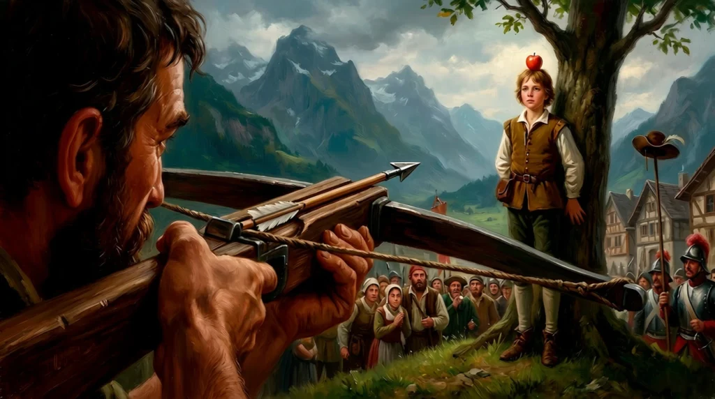
The Matterhorn, it turns out, was never purely Swiss itself. Its summit came from Africa, its base from the floor of a vanished ocean, and its shape from ice. Perhaps that makes it even more Swiss. Like the country's founding legends, which we unpick in Was William Tell real?, its story is more complicated than the postcard. And Switzerland itself has always been built from many parts, as our Swiss history timeline shows.
So next time you see that famous pyramid, on a postcard or from the window of a train in Zermatt, remember what you're looking at. The Matterhorn is an African summit, still moving, sitting on the floor of an ocean that no longer exists.
FAQ: the Matterhorn's geology
Is the Matterhorn African?
Partly, yes. The upper part of the Matterhorn, from about 3,400 metres to the summit, is gneiss of the Dent Blanche nappe. That rock formed on Adria, a block of crust that was attached to Africa when the Alps began to form. The base of the mountain is old ocean floor.
What is the Matterhorn made of?
The Matterhorn has three main parts: ocean-floor rocks and sediments at the base, Arolla gneiss from about 3,400 to 4,200 metres, and darker Valpelline gneiss at the summit. Both gneisses belong to the Dent Blanche nappe.
How were the Alps formed?
An ocean opened between Europe and Africa about 165 million years ago. From around 100 million years ago, Africa moved north, the ocean floor sank, and the two continents collided. Sheets of rock called nappes stacked up and rose, and ice-age glaciers later carved the peaks.
Why is the Matterhorn shaped like a pyramid?
It is a classic glacial horn. During the ice ages, glaciers on four sides cut back into the mountain, leaving sharp ridges and steep faces between them.
Are the Alps still growing?
Yes, slowly. Swiss surveys measure the Alps rising by up to about 1.5 millimetres a year relative to the Central Plateau, while erosion wears much of that height away again.
Which other Swiss peaks are African?
The Dent Blanche, Weisshorn, Ober Gabelhorn and Dent d’Hérens belong to the same Dent Blanche nappe as the Matterhorn. Mont Blanc, the Jungfrau and the Eiger are European.
Sources and further reading
- Wikipedia: Matterhorn (geology section)
- Earth Magazine: Travels in Geology – Zermatt, Europe meets Africa
- Swiss Stratigraphic Lexicon: Dent Blanche nappe
- Swiss Stratigraphic Lexicon: External Crystalline Massifs
- Historical Dictionary of Switzerland (HLS): Émile Argand (in French)
- WSL Institute for Snow and Avalanche Research SLF: The swaying Matterhorn
- Federal Inventory of Landscapes (BLN): Matterhorn – Dent Blanche, object sheet 1707 (in French)
- PermaSense, University of Zurich: Matterhorn field site
- Swissinfo: Areas of Switzerland continue to lose altitude
- Società Geologica Italiana: Diamonds from the Alps reveal carbon mobility in subduction zones
- Food Ingredients First: Toblerone to remove the Matterhorn from its packaging
Last updated 16 October 2026. Featured photo: Roy Egloff, via Wikimedia Commons (CC BY-SA 4.0).